Day 13 - Friday, Oct 6 - Barstow to Joshua Tree to San Diego
Starting mileage: 4420 Starting time: 9:00 am
Ending mileage: 4748 Ending time: 8:00 pm
Travel mileage: 328 Travel time: 11:00 hours
It was about a two hour drive to the Joshua Tree visitor center which had a good display of the geology, history and culture of the park. All of the NP visitor centers we've visited have been very good. Part of the route was retracing our route from Big Bear Lake on Monday but we made a sharp turn to the east just before getting to the San Bernardino mountains.
I should have done more research in advance of our visit as I didn't realize that the geology was actually more interesting than the Joshua Trees and other vegetation. When we were traveling on our way out through Arizona, we went through two passes that had very strange geology with huge smooth boulders all over, many balancing precariously on others. This turns out to be one of the main features of Joshua Tree NP as you may be able to see in the photos below.
Of course there are many Joshua Trees and they tend to be much larger than the ones seen outside the park.
Our first stop was the Hidden Valley. The vegetation on the way there was pretty typically desert with Joshua Trees, creosote bush and some very dry low grass. The Hidden Valley is a ring of low mountains all composed of rounded boulders. Inside there is a microclimate that is slightly more moist so there are pinyon pines, pin oak, manzanita tree and some prickly pear cactus. There is a legend that cattle rustlers hid stolen cattle inside. There is a 1.1 mile self-guided trail inside with numerous informational signs. We were fortunate in finding a shaded picnic table for our lunch.
From there we went to the trail to Barker dam. This dam was built by cattlemen in 1900 to store water for cattle. At the time it created a year-round lake. Now it is ephemeral and this time of year it would normally be completely dry. The naturalist there said that there had been a monsoon 3 weeks before so there was enough water for a small lake. The lake is a favorite watering place for bighorn sheep although we didn't see any. We were pleased to see many flowers that came out suddenly after the rain - in some places the ground was a yellow-gold from some blossoming ground cover. The typical rainfall decreased enough during the 1900s that it was no longer viable to graze cattle there.
This was our last main stop before heading out of the park. We stopped briefly at the cholla grove, a dense but fairly small patch of cholla cactus. It is interesting that areas of vegetation can be so small - these cactus are in an area less than a mile across.
We decided to take the scenic route back instead of the freeways. Leaving the freeway at Indio, we climbed up the Santa Rosa mountains on a very steep winding road that rose about 4000' in 15 minutes. Once at the top, the vegetation was much greener with pine trees and rolling grassy hills. There were many large horse farms along the way - Amy is excited about going back to ride horses!
Other than car problems, we had a great trip together.

 |
| Barker dam |
 |
| Amy with cholla cactus |
 |
| David & Carmen with Joshua Tree |
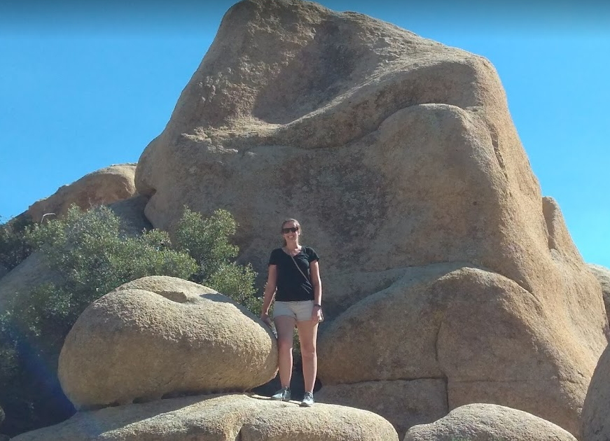 |
| Amy with rounded rocks |
 |
| Squiggly road up mountain |


Comments
Post a Comment